Where in the world?

Where in the world are Mindy and Reinhart now?

Monday, June 20, 2016

On our way to the USA

How quickly can I type?  Please forgive any errors.  Our engine is already running and we are getting ready to leave St. George's soon headed for Newport, RI.  I just figured out that our wifi isn't strong enough to update the blog from the website, so I will be updating via email without any photos for links.  

We have been watching the weather closely since early June to make our trip to the northeast US, but it has been really hard to predict.  This past year has been much harder for us to get a weather window going anywhere than it was back in 2007, or maybe we were just lucky then.   It has given us time to do a lot of other things we hadn't had a chance for, like a very interesting visit to the folks up at Bermuda Radio, who are the Bermuda Coast Guard and port control for the island. 

We weren't quite ready to leave when a window popped up one morning about a week ago.  Lots of folks headed out that morning, and we decided to pull up into one of their spots at the dock, so we could more easily get the boat ready for passage and be ready to leave on a moment's notice.  We stayed in SSB radio contact with two of the vessels and were very glad we didn't leave with them.  The weather turned out to be horrible and they both had miserable trips.  We were glad we were waiting a couple of days, that turned into waiting 3 then 4 then 8 days.  Now there is a big group of us heading to the US, about half the group is going to the Chesapeake, and many of us are heading to Newport. 

We were only planning on spending 2 nights on the wharf, and now we've spent 8 nights.  That is a pretty luxurious splurge for us.  We didn't have power or water here, but being able to hop off the boat whenever you want is pretty nice.  We were also able to get wifi often and check all of the offshore weather support services available to us.  Not surprisingly, the weather directly in Bermuda has also been a little squally this past week, and if we had stayed on anchor we might have been stuck on the boat several of those days to avoid a wet bumpy dinghy ride.  

The other positive thing about being on the wharf was being able to greet and meet the sailors coming from the Chespeake in the Annapolis-Bermuda race.  It has been wonderful for us to socialize with other boats and we are meeting folks that we'll probably get to see again during the boat show.  We were all huddled around computers every morning in the dock master's office checking out the weather.  We might also be keeping in radio contact with them during the passage. 

Now the boats from the Newport-Bermuda race are just arriving, and we'll be passing some of them while we leave.  One of the boats, Comanche, broke the Newport-Bermuda speed record by completing their trip in under 35 hours.  The other boats will be taking at least 70 hours, and we will take ~120 hours.    

We'll have the spot tracker on as usual if you want to see where we are click the link in the sidebar.  If you want to check out the whole fleet of boats arriving and departing Bermuda today check out an AIS tracking website like Marine Traffic.  We should be showing up in Newport by Saturday evening.  Our weather window is good, but spirited, so we might even arrive a day early. 

I may run a test while we are at sea to see if I can update the blog from our super secret emergency email, which can send and recieve tiny email messages over our SSB radio.  

Tuesday, June 7, 2016

I’d rather stay in Bermuda

More than 3 weeks have passed since we arrived in Bermuda, and I haven’t taken any time to write about it.  I’ll try to remember everything that has happened in the past month!   


Our sail north to Bermuda was a different experience every day.  We had fast days that were either uncomfortable or idyllic, we had downwind sails that were miserable or magical, and we had light winds that had us motoring.  We crossed a trough, which promised big winds, big seas, and big rain, but ended up causing us no problems at all.  We had a few problems with our autopilot and wind steering that we’ve had on passages before, and these are things that we’ll continue to troubleshoot. 

We did experience one new predicament – a fouled prop!   One night, the engine rpm suddenly dropped during Reinhart’s watch.  We were both up and about with headlamps trying to figure out what happened.  The engine was thoroughly investigated and then we decided it must be something caught around the propeller.  In the dark, however, there was no way to be sure.  Luckily, the wind was just picking up to something sailable and we set the spinnaker at midnight.

In the morning, we dropped sail so Reinhart could hop into the 16,000’ deep water and look at the prop.  He took all kinds of safety precautions, but I was still terrified.  There was a large green poly net caught around the prop.  Our line cutter on the shaft had done its job cutting all of the lines, so nothing would become hopelessly wrapped around the shaft, but the net managed to stay hooked onto the propeller.  Reinhart could easily pull it off and didn’t have to spend an hour trying to dive down and cut off a tangled mess.  Overall, it was a great first dive on the prop, and much better in the middle of the ocean than in the middle of the Chesapeake.

We arrived in Bermuda at sunset on Sunday May 15, checking in with the friendly and helpful customs and immigration folks in the town of St. George’s, before anchoring for the evening.  Overall, the trip was 878 nm in 151 hours (5.8 kt avg).  It was feast or famine with the winds, and we sailed pretty fast most of the time, but ended up having to motor for 40 hours when the winds died in the middle of the trip. 

We spent one full day on board, cleaning the boat and getting it back into port mode, but since then we’ve been heading into land every day, enjoying Beautiful Bermuda.  When we visited the tourist office we found out that we are famous!  During our trip in 2007, a photographer from Bermuda Tourism took some photos of us in a park with a model, and they are still using one of the pictures in the guidebook.  We were thrilled. 

We started visiting all of those sites that Bermuda is famous for – beaches, forts, churches, and cemeteries.  A few days later we met up with Gary and Chris, our Bermuda experts, and saw some unique beaches and cemeteries that we’d never heard of.  While they were here, Bermuda celebrated its big holiday, Bermuda Day, which acts as the summer kick-off.  The parade in Hamilton was so much fun and had us all feeling like a part of the community.  


A few days later Kevin arrived, and we spent more time visiting beaches, forts, churches, and cemeteries.  We had a great time with Kevin aboard.  The 3 of us visited the Blue Hole Park and Tom Moore’s Jungle.  This was a nice hiking wilderness we visited in 2007 and we thought it would be fun to go back with flashlights.  That decision paid off and we found our way into a large cave.  It was a treat, fumbling around in the slippery salt water cave, blinding each other with our headlamps, steadying ourselves on stalagmites and trying not to bump our heads on pointy stalactites. 

Once Kevin left, we decided to investigate a research vessel, the Atlantic Explorer, which was docked near the airport.  We found out that it is part of the Bermuda Institute of Ocean Sciences (BIOS), and once we called, we found out that they give a tour once a month, and that it was happening the next day.  The tour was so much more than we imagined, and we went to 5 different labs where a scientist gave us their background and a presentation on their current research.  It was all so familiar, with scientific posters of krill, tarapods, and urchins.  We ended with a tour of the Atlantic Explorer, which reminded me so much of the LMG and NBP (it even had an isotope van).  It reminded us so much of our time in the Antarctic program that I became downright homesick for Crary or Biolab. 

Since that highlight we’ve been running around seeing more sights, such as the aquarium and Natural History Museum.  We also attended the St. George’s annual Rubber Ducky Race.  It was a big family fair with lots of fun for kids, local crafts, and dance performances.  The Bermudians host such fun celebrations that make everyone feel like a local. 

Our original plan was to stay about 3 weeks, leaving soon after Kevin departed.  However, Tropical Storm Bonnie was making her way across the Atlantic and it wasn’t the right time to head west.  Now we’ve got TS Colin causing all sorts of commotion in the harbor, with gale force winds forecasted over the next 48 hours.  Once Colin has raced by, there are a couple of low-pressure systems coming off North America that are real humdingers.  It looks like we’ll be in Bermuda for another week or two while we wait for the weather to settle down.  We are in a lovely spot to be weathered-in, and will not be bored with Bermuda anytime soon.

"You can go to heaven if you want. I’d rather stay in Bermuda." - Mark Twain

Saturday, May 7, 2016

Northbound

The view from Colombier
It seems like all of the boats are eager to be on the move right now. Many of the boats are heading south, to get just below the hurricane belt for the summer. That doesn’t sound very pleasant to us, and we’ll be going to Bermuda and then on to the US and Canada instead. Have we mentioned it is hot? It doesn’t sound so bad – it gets into the high 80s during the day and drops into the low 80s at night. However, with both the heat and humidity on the rise, it is on the sweltering side of comfortable right now, and it is time to go north.

Rockhopper on a mooring in Anse du Colombier
We spent the last week of April preparing the boat for passage in lovely St. Barth. We spent a couple of nights in the outer anchorage at Gustavia, which started getting a little rough when the winds turned and left the open anchorage exposed. We then headed over to quiet Anse du Colombier for 3 nights. Colombia  is a protected bay in the marine park; it has great swimming and a couple of nice hikes. 

One day we walked to one of the beaches on the north side of the island, and saw several tortoises, iguanas, and few other large lizards. We also hiked up to the village of Colombier which sits on a cliff 500’ over the bay. We spent a lot of time checking systems and rigging, and moving our “fun” gear into deeper storage while making our safety and rescue gear easily assessable. Lots of stuff has to wait for last minute though, like deflating and stowing the dinghy on deck, and setting up the windvane. 

We are back in St. Martin now. We entered the lagoon to fill up our diesel tanks before we leave on passage, just over 100 gallons this time around. We were thrilled to drop our anchor and discover that we have access to wifi at the boat for the first time in the lagoon – unlocked wifi has been a pretty rare occurrence anywhere this time around. There was lots of shopping to get accomplished as well.  The variety of items at the grocery stores is excellent, the prices are comparable to the US, and vices (alcohol and cigars) are duty free, so we are happy to take advantage of that as well. We had oodles of last minute things to do, but now that we are “stuck” here in paradise, we have to undo and redo some of our preparations while we wait. 


This is the ominous weather system we are avoiding.
We were hoping to be on our way north at this point already. However, a large low-pressure system in the US is affecting the weather from Bermuda all the way down to the Caribbean, and we are waiting it out. We’ve been listening daily to our favorite weather man, Chris Parker, discuss the weather with his subscribers at 6am (ugh).  Some of them are caught up in violent squalls and we are glad we waited. We think we’ll end up leaving this Monday after the trough has dissipated. It is just a week later than what we planned, but it feels like we’ve been waiting for weeks. The trip from St. Martin to Bermuda is 900 miles, which will take 7-9 days of 24 hour sailing. Reinhart and I alternate 3-hour on-watch shifts.  Back in 2007, it took us just 6 days to make it, but we were sailing extremely fast and can’t count on that every time. No matter what, we are hoping to arrive by May 18. 

Once we head out, we’ll start sending daily-preprogrammed location emails to a small list of folks using the spot tracker. If you are interested in tracking us, here is the link to Rockhopper’s spot page, which shows the last 7 days of locations. Another way to check us out is by using a marine traffic tracking program to see our AIS signal, like marinetraffic.com.

Rockhopper Anchorages:
17°54.011N 062°51.469W; Gustavia Outer Harbor, St. Barth 25-26Apr16
17°55.503N 062°52.146W; Anse du Colombier mooring, St. Barth 27-29Apr16
18°02.374N 063°05.648W; Simpson Bay Lagoon, Sint Maarten; 30Apr16…


Tuesday, April 26, 2016

Lollygagging in the Leewards

A spotted eagle ray under the boat.
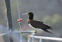
and a booby on the bow


We circumnavigated St. Martin. We spent some time in chic Marigot, had a couple of lovely nights and a fabulous meal in gastronomic Grand Case, spent an evening on a mooring off the deserted island of Tintamarre, and ended up in famous Orient Beach for a night. Reinhart took the photos below in one of the anchorages. We’ve both often said “what green flash…you guys are just imagining it”, but now that we caught it on camera, we have to apologize to you (for instance, Cara).  


Green Flash!
Almost there...


Les Voiles de Saint-Barth, Day 2 start
We heard there was a race in St. Barth, so we sailed over a day early hoping to catch it. We were so glad we got in early enough to get a good spot in the outer anchorage, because it filled up over the next several days. The race is called the Les Voiles de Saint-Barth, and there were many classes of race boat represented. The boats ranged from 22’ with 6-8 crew members all the way up to over 100’ with 20-25 crewmembers (mostly rail meat). It was a lot of fun climbing up to Fort Carl and watching the boats waiting together in the start area with their main sails up. We’d listen to the VHF radio announcement of each race start and try to figure out which class would be hoisting their headsails and taking off. The wind was very light for the whole week, so they weren’t particularly fast races. The time passed quickly in St. Barth though, and before we knew it a week had passed.

During the race, a few different classes represented
We were eager to get back to St. Martin for a gathering of northbound sailors on Saturday afternoon. We checked-out of St. Barth customs/immigration/port control on Saturday morning, weighed anchor, had a lovely 3 hour sail back to Simpson Bay, anchored outside of the bridge, checked-in with Dutch St. Maarten customs/immigration/port control, and were at Lagoonies in time for a good seat for the presentation! We stayed in town a few more days to do a couple thousand dollars of upgrades to the boat (St. Martin is good and bad that way). We checked-out and weighed anchor before we could do any more improvements to the boat (or damage to the bank account) and headed for Saba.


Click here to look at our sailmaia blog from May of 2007 where we talk about our similar experiences in the Leeward Islands. 

The Bottom, Saba
Saba was one of our favorite islands in 2007.  That year, we had anchored in Ladder Bay, beached the dinghy every day and walked up hundreds of steps to visit the island. We had a magical broad reach down to Saba, and due to a late start came into Fort Bay on the south side of the island a little later than expected. The park moorings were all taken and we anchored in the extremely rough port to check-in and speak with the marine park representative. He discouraged us from going to Ladder Bay to pick up any of those empty moorings because of the large swell, and he said we shouldn’t ever try to land a dinghy there, and seemed a bit shocked that we had in the past. 

Windwardside cottage
The next morning we switched over to a vacated mooring and headed in to walk the steep volcanic island. First, we walked up the steep road from the port to the village of The Bottom. The town was just as clean, quiet, and pretty as we remembered. We went over to the west side and walked down The Ladder. The beach at the bottom of The Ladder is no longer there; all of the sand has washed away and left a thin strip of rocky land. We understand why no one lands dinghies anymore! We had lunch in town and felt shabby compared to all of the business folks dressed up for work in suits and dresses. One of the things we loved about Saba that hasn’t changed is their wonderful trail system. Until the 1950s, these tracks were the only way to get around the island, so they are mature and well maintained. This time, rather than hiking to the top of Mt Scenic (at 3000’ is the highest point in the Netherlands!), we hiked up and across the island to the town of Windwardside. Windwardside is similar to The Bottom, almost as charming but with a better view of the ocean, and a bit more of a touristy feel…no suits and dresses on this side! We headed back over the trail and realized we might have been overambitious with our walking. I had no problem with the uphill portion, but the 2000’ back down to the boat was very hard for me and I had to take it pretty slow, getting us back to the dinghy just after sunset. The winds and waves had not calmed at all and we spent one of our roughest nights ever in a harbor – it felt like we were on passage. In calmer conditions we probably would have spent another night or two in Saba, but it was just too much, so we decided to sail over to St. Eustatius (Statia) and hope Oranjestad was a bit calmer.

Rockhopper in the line of fire at Oranje Baai
The sail over to Orangestad was not nearly as nice as our broad reach to Saba a couple days before.  We were close hauled in choppy conditions and those few hours seemed longer than they actually were. We were thrilled to pull into Oranjestad and find the anchorage was unusually calm…for one night. The harbor got progressively rolly over the next couple of nights and we ended up setting a stern anchor, which successfully kept us pointed into the swell. We walked up the cobbled path to the upper town. When we were here in 2007 they were doing a lot of restoration, and those efforts have come a long way. 

Reinhart in The Quill, Statia
Another day we hiked up and into the dormant Volcano known as The Quill, and another day we snorkeled the old port ruins in the harbor. Statia has a very interesting past to consider as you walk the historic streets. There is a population of ~3500 people, but it has come down considerably since the 1700s, when it was a major Caribbean port. Like Saba, it is very clean and friendly, and unemployment is low, giving the island an authentic feeling rather than seeming like it is only a tourist destination. Both islands are known for their extensive diving opportunities and good hiking, but they don’t have great beaches or ports suitable for cruise ships, so they are somewhat overlooked by the tourism industry. I could spend weeks in these quiet Dutch islands, but after three nights, it was time to start making our way back north. 

Mindy at the top of The Ladder, Saba
We are now back in St. Barth. We decided it would more fun to do some preparations and provisioning for our passage here in addition to St. Martin.  We arrived yesterday afternoon and found out there is yet another race (the finish line of the Transatlantic race, Transat Ag2r) and the St. Barth Film Festival, so we’ll see how much work we managed to get done. We’ll still spend a few more days in St. Martin to fuel up and wait for a good weather window to Bermuda. I’ll update the blog one more time next week before we leave with details of the passage. 

Rockhopper Anchorages:
18°04.059N 063°05.565W; Marigot, St. Martin; 05Apr16
18°06.253N 063°03.420W; Grand Case, St. Martin; 06-07Apr16
18°07.056N 062°59.313W; Tintamarre Island mooring, St. Martin; 08Apr16
18°05.138N 063°00.885W; Orient Bay, St. Martin; 09Apr16
17°53.923N 062°51.444W; Gustavia Outer Harbor, St. Barth 10-15Apr16
18°01.964N 063°05.829W; Simpson Bay, Sint Maarten; 16-19Apr16
17°36.816N 063°14.769W; Fort Bay mooring, Saba 20-21Apr16
17°28.838N 062°59.346W; Oranje Baai, St. Eustatius 22-24Apr16
17°54.011N 062°51.469W; Gustavia Outer Harbor, St. Barth 25Apr16…


Tuesday, April 5, 2016

Lagooning in Sint Maarten


We arrived in St. Martin after a long overnight motor into the wind and waves. We anchored in Simpson Bay, outside of the lagoon and decided to hang out there until Seana arrived. We had some pretty posh neighbors with Eclipse, a 163-meter giga-yacht, which is too large to make it through the bridge into the lagoon. However, the conditions were getting windier and windier and the anchorage, although protected, started getting pretty rolly. The day of Seana’s arrival came with the crushing news that her trip would have to be postponed. It was a sad day for us, but we decided to move into the lagoon for a gentler anchorage.

Eclipse (super-yacht or mega-yacht or giga-yacht?)
It is always fun going though the Simpson Bay bridge: circling with vessels large and small and waving to the audience at the Yacht Club. Now we’d have a few more days to enjoy the things that make Simpson Bay Lagoon a great anchorage: the large cruiser community, $1 beers, super marine stores, boat parts galore, wonderful grocery stores, 747s buzzing the anchorage, and watching the world’s largest superyachts maneuver in and out of the lagoon.  We enjoy listening every Mon-Sat morning to the 7:30am cruiser net hosted by Shimpy. I joked that I could barely make it to our 7:30 work meeting at McMurdo Station, but somehow I wake up voluntarily for the net every day. One of the things we don’t like in the lagoon is that folks go full throttle in their dinghies, planing straight through the anchorage. We don’t like it because it is loud, and rocks the boat, and makes us very jealous.  Reinhart has already gone by the Yamaha dealer to see if we could buy a new engine. The prices are excellent here, but the wait time is long, and we’d probably be better off waiting for the boat show next year. 

Sailing Yachts inside the Lagoon
A few windy days passed and it was time for Cara to visit. We were so thrilled when she arrived, we could barely contain our excitement! (If we haven’t mentioned it, we love having friends and family visit).  We had thought up all kinds of plans, which had whittled down a bit due to the strong winds that prohibited us from visiting several anchorages and nearby islands. We ended up spending a couple more nights in the lagoon. We visited the beachy Dutch city of Cole Bay where all of our happy hour haunts and marine stores are located. The following day we visited Marigot, a chic town on the French side.  We arrived soaking wet, from the windward dinghy ride, but enjoyed our day walking around the little shops and cafes. 

Gustavia's inner harbor
Weather be damned, we decided to make the 15 nm trip to St. Barthelemy. We can take anything for 3 hours, right? Well, the winds were even stronger and waves more confused than forecasted and the trip ended up being 5 hours of misery. We anchored outside of the full Gustavia harbor, once again with the mega yacht neighbors that couldn’t make it into the Harbor, boats like “Eclipse”, “A”, and the “Rising Sun”, amongst others. The trip was absolutely worth it for all three of us as we strolled the cobblestone streets. Gustavia is spotlessly clean, casually elegant, and breathtakingly beautiful. We noticed that outside of the island, everyone refers to it as St. Barts, but on the island, they say St. Barth; remember that when you want to sound like the sort of moneyed individual that spends their winters there.  We took another magical stroll after sunset and Cara treated us to a wonderful dinner. The next day we came back into the city to check out more of the shops and visit the weather station and lighthouse on the hill with beautiful views. From there we also had an interesting angle for viewing the planes landing at Barth’s infamous airfield –it looked like they were flying directly into the hill over the airport. 

Those unrelenting winds made Gustavia’s outer anchorage a bit rolly, so we had a lovely sail that afternoon to Anse du Colombier, where we picked up a park mooring. Colombier is a beautiful anchorage with a long curve of hill-backed beach and clear turquoise water.  We finally got in some swimming, beach combing, and grilled out that night.  The next day we headed back to St. Martin with a much more favorable point of sail.  We entered the lagoon with the 5 o’clock bridge, waved to the happy hour patrons at the Yacht Club, and joined them by 6pm, for our own drinks and free wifi. 

The next day was a bit sad for all of us, as it was Cara’s departure date. We made the best of it by dinghying to the airport for check-in and then heading to Maho Beach (aka Jet Blast Beach) to watch the jets land low over the sand and take-off blasting the beach goers.  We noticed the pilots of American companies are careful not to blast folks too generously, but the pilots of the larger island airlines really blast the beach, knocking people off their feet and sending all kinds of hats, shirts, and toys into the water.  We got Cara back to the airport on time, and headed back to the boat, unsure of what to do with ourselves. The winds were still a bit strong for some of our favorite nearby anchorages, so we decided to stay in the lagoon through the weekend.  We finally got our tax information uploaded to our accountant, and purchased a few more supplies for boat maintenance/improvements/upgrades.  Reinhart’s birthday was Sunday, and we celebrated with a Rum cake for breakfast, a long walk on one of St. Martin’s extensive beaches, and ice cream in the afternoon, of course! 

It is really handy to do boat maintenance and improvements while anchored in the lagoon since we can run to the store for supplies or to a bar for research-wifi at any time. However, the lagoon is city life, and we are longing for the peaceful anchorages we had in the Virgins. We checked-out of the Dutch side this morning, headed out the bridge, and sailed around the west side of the island.  We’ve anchored in the lovely town of Marigot on the French side (just above the lagoon).  The water is bright and clear here, so we can clean off the lagoon growth from the hull.  In the next week or two we’ll visit some of the French side anchorages and then on to St. Barth and maybe further (Statia, Saba, Kitts, Nevis) in search of clear water in which to swim and snorkel and lovely trails to hike. 

Rockhopper Anchorages:
18°01.915N 063°05.839W; Simpson Bay, Sint Maarten; 16-20Mar16
18°02.421N 063°05.656W; Simpson Bay Lagoon, Sint Maarten; 21-26Mar16
17°53.997N 062°51.407W; Gustavia Outer Harbor, St. Barth 27Mar16
17°55.492N 062°52.174W; Anse du Colombier mooring, St. Barth 28Mar16
18°02.403N 063°05.694W; Simpson Bay Lagoon, Sint Maarten; 29Mar-04Apr
18°04.059N 063°05.565W; Marigot, St. Martin; 05Apr16


Monday, March 14, 2016

Meeting friends in the US Virgin Islands

The Virgin Gorda Baths
We spent a few days at the beginning of March at Virgin Gorda, anchored in one of our favorite spots near “The Baths”. Each night we had several neighboring French-flagged boats. This anchorage isn’t mentioned in any of the English guidebooks, but I wonder if there is a French guidebook that extols its beauty. We had a nice couple of days visiting Spanish Town, swimming, snorkeling, and exploring the unique boulder formations of The Baths.

Our month in the BVI was almost up, and we had some business to do in the USVI, so we decided to get over to Jost Van Dyke to check-out of the BVI. Most of our sails so far have been close-hauled motorsails as we made our way eastward in the BVI, but this was a fast and luxurious broad reach westward back to Jost Van Dyke, which was over too soon. We arrived in Great Harbor and decided to pick up a $30 mooring on a whim, because one was available. What a great decision!  It turned out to be a huge night at Jost Van Dyke, and the anchorage was packed a few hours later. Even our new friends on “40 Below” were there. We were entertained that evening by the raucous activities in the harbor, and the next day we dinghied in to check-out of the BVI and sailed over to Cruz Bay, St. John to check into the USVI. We headed straight over to anchor in Red Hook where we’d be meeting up with old friends, Kristi and Will, and their newly arrived guests.

Rockhopper at Anchor
When we left the British Virgin Islands, we had all sort of “ideas” of what we wanted to do in the USVI; we avoid the use of the word “plans”. We were between spending a day or two in St. Thomas then a couple days in St. John, or maybe we should go ahead and spend several days in St. John. Well, I guess that is the reason we avoid the word “plan” because we have been thrilled with events over the past week that never could have happened if we let “plans” get in the way. 

We met up with Kristi and Will and their friends, Denise and Gary at the American Yacht Harbor and had a delightful dinner. Red Hook was a miserable anchorage with high winds and swells coming into the Harbor. Boats were dragging around and we had to keep an anchor-watch up over night. We hated to leave since we wanted to spend more time with the gang, and Kristi and Will suggested we anchor near their home in Secret Harbor. 

Secret Harbor...maybe it really is a secret!
Secret Harbor is a resort on the southeast coast of St. Thomas and the guidebooks barely mention it; however, it is a wonderful spot to spend a few days. At this point, I’ll start to use “generous” a lot, because Kristi and Will generously let us use their laundry and their lovely home as a base camp; they generously bought us wine, fed us, and took us to the grocery store; they generously gave us care packages every time we showed up at the door; and they generously shared their friends with us. We all had such a great time, dining at the unique places in Red Hook, listening to fun music, and hanging out at the Secret Harbor beach. We were thrilled to have everyone over for sundowners (and midnighters) one night and then went for a day sail over to Little Lameshur Bay on St. John one day. We joined Denise and Gary on a ferry trip over to St. John for the early St. Patrick’s Day parade and had an amusing time perusing the lovely shops of Cruz Bay. Before we knew it, a week had passed! Now Denise and Gary are back on a plane to Connecticut, Kristi and Will are both at work recovering from entertaining us all week. We feel like we have a new set of lifelong friends, and I’m sure we’ll meet up with Denise and Gary when we find our way up north year later this year. All of this fun has also made us start to reconsider some plans for next season, and we might try to find a way to spend a few months in the US Virgin Islands next year.

Now it is time to straighten up this boat and get her ready for the 20 hour passage over to St. Martin and ready for our own guests!  Seana is coming in for a few days, and then Cara will be right behind her, so our aft cabin will finally be housing guests March 20-30, rather than acting as a utility closet.  The next update will be coming from St. Martin…same latitude, new longitude.

Rockhopper Anchorages:
18°25.267N 064°33.752W; Buck Island, Tortola, BVI; 01-02Mar16
18°26.330N 064°26.659W Valley Trunk Bay, Virgin Gorda, BVI; 03-05Mar16
18°26.492N 064°45.087W Great Harbor Mooring, Jost Van Dyke; 06Mar16
18°19.561N 064°50.681W Red Hook, St. Thomas, USVI; 07Mar16
18°19.036N 064°51.199W Secret Harbor, St. Thomas, USVI; 08-14Mar16
18°19.088N 064°43.566W Little Lameshur Bay Mooring, St. John; 10Mar16

Wednesday, March 2, 2016

Three weeks in Paradise


We’ve been here several weeks now and we are doing things differently from when we were here a few years ago.  Looking back at our entries in our 2007 blog, we realize we were experiencing the Virgins similarly to the charter folks – a different harbor every night.  We rarely stayed two nights in one spot.  This time around we are staying several nights at each stop.

When we last updated you, we were still anchored in Jost Van Dyke.  It was so much fun to hang out in Jost and watch the daily changeover of boats.  It is a big stop in the charter circuit, and folks make a point in getting there early to fight over the moorings.  By the end of each evening, the moorings and anchorage were packed, there was a large yacht or two anchored outside of the harbor, and often there was a Windjammer or another cruise ship.  The last couple of days in Great Harbour started getting a little “sloppy” with swells making their way in and opposing winds picking up.  It was time to leave and we decided to make a short trip over to the north side of Tortola.

Surfer in Cane Garden Bay
We arrived in Cane Garden Bay on Tortola and anchored just outside of the mooring field.  This location ended up being the spot to pick up floating items blown off other boats.  We returned a sneaker to the beach, a fin to a tall ship, and a fender to a charter boat.  This was the second place we anchored in the BVI, and once again we didn’t seem to be able to pick up a wifi signal at the boat; it turns out this will be the norm for the trip.  Cane Garden Bay has a cute town with a pretty beach and an old Rum distillery where they let you try all of their products for a grand total of $1.   There were large groups of tourists brought in daily from the cruise ships in Road Town, and a lot of activities were set up to entertain them.  Our biggest entertainment; however, were the large breaking waves on the rocks nearby making a perfect surfing spot for the locals.   Almost all of the boats we see are charter boats, but there are some cruisers (like us) as well.  A cruising couple from New Bern on their Island Packet, “Charbonnneau”, anchored nearby.  We dinghied over and it was great catching up with some folks from NC.  A bigger blow was in the forecast and we decided to head to the west side of the island for better protection.

Norman Island Bight (Willy T & Rockhopper in foreground)
Everything is so close in the BVI, so it was wonderful to have a 2-3 knot sail over to Soper’s Hole on the West End of Tortola and not be worried about coming in late.  We know from experience that Soper’s Hole is deep, so we knew we’d be picking up a mooring.  What we didn’t expect was to get a mooring on the front row so late in the afternoon.  Alas, no wifi at the boat.  We could barely pick up Pusser’s wifi signal when we were sitting in their restaurant. Soper’s Hole is always a fun stop with the range of boats and lots of land activities.  This was the first stop where we didn’t want to swim near the boat, so we walked up the street into the neighborhood nearby and eyed some of the beautiful properties.  We decided to spend a second windy night on the mooring and late in the evening, we were thrilled to see “Charmed Life” sailing in.  It was great to catch up with Mike and Sharon while we were there and hopefully we’ll be able to meet up with them again when we all have time.  The winds were back down the next day and we were ready to be on our own hook again.  

We decided to head over to The Bight on nearby Norman Island.  We weren’t planning on picking up a mooring, good for us since there were barely any available at 3pm on a Sunday.  We anchored along with the big yachts just outside of the mooring field.  It turns out that Sunday is the big night at the local bar,  “Willy T” with lots of new charters and the locals coming over from Tortola.  We had a great time watching the local speedboats come in and listening to the crowd at Willy T.   The next day we re-anchored right next to the bar – it is a very protected spot although the bar is a little rowdy to call it a quiet anchorage.  It is another “must stop” in the charter circuit and the anchorage emptied out every morning and filled up in the afternoons.  It was fun to watch the customers leaping from the bar roof into the water at all hours.  There is a gorgeous snorkeling spot right around the corner from The Bight, so we snorkeled and swam every afternoon. Norman Island also has several trails that afford wonderful views of the BVIs.   The Bight is a great anchorage, but every night the wind funneled over the hills and was bothersome.  We checked the old blog, and we complained of gusty winds at that time as well. We decided to head somewhere even quieter.

Med moor in Little Harbour, Peter Island
We pulled into Little Harbour on Peter Island and anchored in the middle of the peaceful bay.  It was more beautiful than I remembered.  There were three of us anchored in deep water in the middle of the bay, but several boats had their sterns tied to shore in the shallow water (med moor).  That night we experienced a “first”.  We were awoken by a disturbing crash that sent us scrambling onto deck.  Some kind of large sea creature flew headlong into one of our dorades and tore it off of the boat.  There was a lot of blood on deck, but we never saw what actually happened.  The next day we decided to med moor as well.  We left the anchor where it was and used two long lines to tie to rocks on the shore before shortening up our anchor rode to keep us perfectly balanced over the bright shallow area. The snorkeling right off the boat was wonderful and we still enjoyed the turnover of charter boats and yachts on a daily basis, although several boats were staying in this idyllic anchorage for a longer time.  We were moored beside a catamaran named “40 Below”, and we ended up spending 3 nights enjoying Ron and Barbara’s charming company with sundowners or dinner.  Little Harbour is the prettiest anchorage we’ve ever been in and is the type of place we could stay for weeks; however, it had been 10 days since we had wifi access and I was about ready to find a good grocery store with some freshies. 

South side of Norman Island
We finally headed out and made our way to the east end of Tortola.  Ron and Barbara had suggested an anchorage near a town with a great grocery store and an American style coin laundry.  We are currently anchored with one other sailboat in the lee of Buck Island.  It is a big dinghy ride for us to get into town, but they weren’t kidding about the grocery store – it has its own dinghy dock!  The laundry is a really nice place, and we’ll keep it in mind, but we’ve been doing all of our laundry in our “wonderwash” on board and will probably wait until St. Martin to bother with the larger stuff.  We still don’t have wifi on the boat, but there was a good signal at a great restaurant in town and we are going to head over there tonight with all of our electronics and get all caught up and finally publish this blog!

Rockhopper Anchorages:
18°26.462N 064°45.060W; Great Harbour, Jost Van Dyke; BVI; 09-14Feb16
18°25.693N 064°39.670W; Cane Garden Bay, Tortola; BVI; 15-18Feb16
18°23.143N 064°42.113W; Soper’s Hole (mooring), Tortola; BVI; 19-20Feb16
18°18.849N 064°37.158W; The Bight, Norman Island; BVI; 21-24Feb16
18°21.329N 064°36.030W; Little Harbour, Peter Island; BVI; 25-29Feb16
18°21.329N 064°36.030W; Buck Island, Tortola; BVI; 01Mar16